
Evanston ZIP Directory Coverage
Six codes appear in official or regulatory sources for Evanston or special Evanston postal destinations. They do not form six clean residential districts. The three standard codes require a map check near city lines, while the other codes include a PO Box destination and Northwestern routing.
| ZIP | Area or destination | Postal role | Evanston note |
|---|---|---|---|
| 60201 | Standard Evanston addresses | Residential and city delivery | Often north or central, but not a legal boundary |
| 60202 | Standard Evanston addresses | Evanston routing | South and central descriptions need a GIS check |
| 60203 | Evanston postal area | Standard routing | May cross the city line |
| 60204 | Limited destination | PO Box oriented | Not a normal parcel-residence code |
| 60208 | Northwestern campus | Unique institutional routing | Not a general household proxy |
| 60209 | Northwestern destination | Special residential routing | Verify the current assignment |
Census ZCTA profiles may show fewer codes because a ZCTA is a statistical approximation. It does not represent every PO Box or unique institutional code.
Evanston ZIP Codes 60201-60203
The standard Evanston codes work well as a first filter, but phrases such as north, central, or south Evanston are only practical descriptions. They are not official parcel boundaries. For 60203 in particular, compare the ZIP polygon with the city line before calling every mailing address an Evanston municipal address.
The Cook GIS ZIP boundary layer publishes a polygon service with a ZIP field.
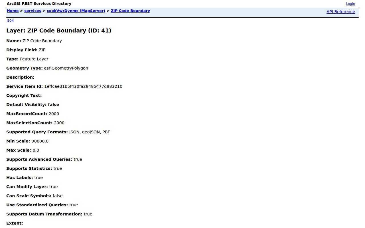
The layer supplies postal geography for comparison. It must be viewed beside Evanston's city boundary and parcel data, not treated as a resident roll.
Evanston's Three Special ZIPs
60204, 60208, and 60209 make this ZIP code directory unusual. A 60204 PO Box is a delivery destination, not a situs address. Situs means the physical location assigned to a parcel. It says nothing by itself about who receives the box.
Northwestern's mail guidance says residential students should normally use a full street address with Evanston, Illinois 60201. Code 60208 serves non-residential campus mail and can delay residential delivery when used in error. USPS description material identifies 60209 as a special Northwestern residential destination. Both require current verification rather than a citywide inference.
Verify an Evanston ZIP Address
The USPS ZIP Code Lookup accepts a street address, city, and state, then returns the ZIP and ZIP+4. Include any secondary unit. USPS verifies delivery formatting, not title, city jurisdiction, or occupancy.
- Enter the complete street number, name, unit, city, and Illinois in USPS lookup.
- Open the Cook ZIP polygon and mark the returned postal area.
- Compare the point with Evanston City Boundary in the local Property Browser.
- Select the parcel in CookViewer and record its PIN, the county's 14-digit parcel number.
- Use the right record source for the question, such as assessor, permit, voter confirmation, or archive.
This sequence keeps postal, municipal, and parcel facts separate. Once a search narrows to one road, use the Evanston street directory for address-level work.
Map Evanston ZIP and City Lines
The City of Evanston maps hub links the Property Browser, About My Place, historic images, and a street index.
Local layers include city boundary, wards, parcels, zoning, historic districts, and annexation chronology. The city warns that cadastral map data are schematic, not a legal survey. Recorded plats and legal descriptions control lot and subdivision questions.
Evanston expanded through annexations in 1873, 1874, 1886, and 1892. Those dates explain why an old directory or deed may use a different municipal label. No official citywide ZIP split date or comprehensive street-renumbering table was located, so historical claims should keep the source and map date attached.
Evanston Services by Address
The About My Place address service connects a city address with a ward, council member, refuse, recycling, and street services.
That output is a municipal service context, not a directory of residents. It helps test whether the address belongs in a city system after USPS has standardized the mailing form.
Other routes remain available when a web map fails: call City 311 or the permit desk, contact Cook GIS or the Assessor, ask USPS about current delivery, or visit the relevant counter. EPL and EHC hold historic maps and directories. Illinois State Archives and IRAD can help with older annexation or municipal series. An Illinois Freedom of Information Act request may reach an existing administrative map or readdressing record, but it cannot make USPS create a historical list.
Evanston ZIP Search Fields
No local assessor control was verified for a ZIP-wide search. The Assessor address form offers street details and city, while CookViewer's captured modes focus on parcel PIN and address. The Illinois voter lookup does use ZIP, but only within a personal registration check.
| Source | ZIP input | Other fields | What it returns |
|---|---|---|---|
| USPS lookup | Result and ZIP+4 | Street, unit, city, state | Standard delivery address |
| Illinois voter lookup | Five digits required | Name, birth date, street number, street selection | Personal registration confirmation |
| Cook GIS | ZIP polygon layer | Map selection and parcel tools | Boundary context, not a name list |
| Cook Assessor | No verified ZIP field | Address, PIN, city, neighborhood mode | Parcel assessment details |
Illinois voter lookup is not a downloadable block or household roll. Regulated voter-file access has separate state rules, permitted purposes, and request channels. Use the public form only to confirm the registration details of the person whose information is supplied.
Evanston ZIP Boundary Terms
Postal and map terms look alike until they produce conflicting answers. Keep each label with its source.
- ZIP code
- A USPS delivery code. It is not a city limit or legal parcel line.
- ZIP+4
- The base five digits plus four digits that narrow a delivery segment.
- PO Box ZIP
- A code aimed at post-office boxes rather than ordinary street parcels.
- Unique ZIP
- A code assigned to a large institution or special destination.
- Carrier route
- A delivery path used by USPS, which may cross other civic boundaries.
- ZCTA
- A Census Bureau area that approximates a ZIP for statistics.
Note: Preserve the map date because routing, web layers, and city systems can change without rewriting older records.
Evanston ZIPs Versus City Limits
A valid mailing label can say Evanston while the parcel lies outside the municipality. The reverse can also occur when a city parcel uses a different postal label or special routing. Compare USPS, Cook ZIP polygons, and Evanston City Boundary for every uncertain address. This is most important for 60203, while 60204, 60208, and 60209 require a destination warning.
The Evanston ZIP code directory should record the type of boundary beside every result. Postal code, city limit, ward, zoning district, historic district, and association line answer different questions. A date matters too. Web maps and delivery routes can change while an old deed or directory keeps the label used when it was made.
ZIP geography narrows where to look. It does not show ownership, current occupancy, or a complete set of residents. The Assessor's property location is also not a legal or postal mailing address. Use a PIN and recorded legal description for parcel questions, and use only lawful personal research. Never use a directory to stalk, harass, or harm anyone.